Contact Us

New York City

Sargent, G.F., City of New York, 1850s.
-
Brooklyn Visual HeritageThe Brooklyn Visual Heritage website provides access to a newly digitized corpus of 19th and 20th century photographs and other visual materials drawn from the rich collections of the Brooklyn Historical Society, Brooklyn Museum and the Brooklyn Public Library.
-
Brooklyn: Musem of the City of New York Image CollectionOriginally known as Breuckelen, this independent city became a borough of New York City as a result of the creation of Greater New York in the consolidation of 1898. The Museum's extensive collection of images depicting Brooklyn show the Battle of Brooklyn, the evolution of Prospect Park, and the transition from vast farm lands into dense urban settlements, among other themes.
-
Historic Brooklyn Photographs: Brooklyn Public LibraryThe Brooklyn Collection is Brooklyn Public Library's local history division, providing a range of information and services about anything and everything Brooklyn. Our rich assortment of research materials and archival documents includes maps, historic Brooklyn photographs, ephemera, prints and the full run of the Brooklyn Daily Eagle.
-
Photographs of New York City and Beyond: New York Historical SocietyBrooklyn Revealed offers a photographic tour of Brooklyn, through which visitors will learn about individual neighborhoods as well as the origin of more than 100 Brooklyn street names.
-
Manhattan: Musem of the City of New YorkManhattan was originally inhabited by the Lenape Indians, who called it Mannahata. The Dutch established the settlement of New Amsterdam in 1624; when the English took the territory from the Dutch in 1664, they renamed it New York. Today, Manhattan is home to more than 1.5 million people and is one of the most densely populated places in the United States.
-
Queens: Museum of the City of New YorkThe borough of Queens is one of the most ethnically diverse areas in the world, with inhabitants from more than 100 different nations. The Museum's collection represents both the industrial and residential evolution of Queens, as well as attractions such as Flushing Meadow Park and the Aqueduct Racetrack.
-
Photographic Views of New York City, 1870s-1970s: NYPLFrom New York Public Library: More than 54,000 New York City archival photographs (and their captioned versos) from the 1870s-1970s arranged by borough and street; the majority are exterior building views and neighborhood scenes from the 1910s-1940s.
-
Streetscape and Townscape of Metropolitan New York City, 1860-1942: NYPLFrom New York Public Library: Several hundred prints and photographs offering the complete content of a wide range of selected image collections and illustrated monographs: Hudson River mansions, including Washington Irving's home and vicinity in the 1860s; street views by Alice Austen from 1896; a panorama of Fifth Avenue from 1911, and more.
-
Changing New York: Photographs by Berenice Abbott, 1935-1938: NYPLFrom New York Public Library: Hundreds of black and white photographs by Berenice Abbott (1898-1991) from her Changing New York Works Progress Administration/ Federal Art Project. The Library's collection holds about 80% of the project's 302 images; this presentation includes variant and discarded images, plus other work Abbott produced as a project employee.
-
"Drugstore Photographs, Or, A Trip Along the Yangtze River, 1999;" Lower Manhattan Block-by-Block by Dylan Stone: NYPLFrom New York Public Library: 26,000 color snapshot photographs taken in 1999, recording the streetscape, block by block, of Manhattan south of Canal Street, and arranged in an archive by neighborhood and block.
-
Metropolis: New York City Water and Transit Infrastructure in Photographs: NYPLFrom New York Public Library: Over 600 images, primarily original photographs, plus selected published sources, on the themes of traffic, transit and water. The digital collection includes mass transit proposals and projects, dating from 1867; the multi-county Catskill Aqueduct system that still supplies the city's water; and the pioneering Holland Tunnel for vehicular traffic under the Hudson River.
-
Digital Culture of Metropolitan New YorkA variety of local collections from all five boroughs, including photographs of various locations.
New York City Maps and Plan - Pratt Resources
-
Avery/GSAPP Architectural Plans and Sections Columbia University: ArtstorInternational modernist architecture in plans, sections, photographs, models and renderings.
New York City Maps and Plan - Non-Pratt Resources
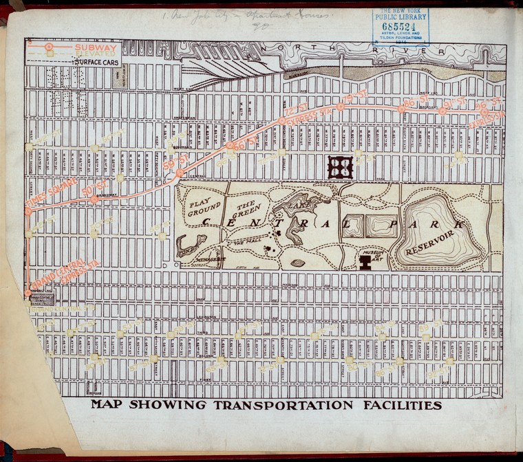
Image Caption: Map showing transportation facilities. [42nd - 98th Streets]
-
Maps: Museum of the City of New YorkThe Museum's Map collection is geographically centered on the five boroughs of New York City and its environs, and depict the landscape from the 17th, 18th, 19th, and 20th centuries. The maps range in variety from street maps, land auction maps, cadastral maps showing the boundaries and owners of lots of land, maps of city parks, transit maps, and topographic maps.
-
Early Real Estate Atlases of New YorkFrom New York Public Library: Over 2,000 maps of New York City, including Manhattan and Brooklyn "fire insurance maps" from the 1850s-1860, showing streets, blocks, tax lots, natural and manmade features, and more.
-
Classic 6: New York City Apartment Building Living, 1880s-1910s: NYPLFrom New York Public Library: More than 1,300 digital images depict elevation views and floor plans for middle and upper class apartment buildings from New York City's pre-World War I residential building boom.
-
New York Real Estate Brochure Collection: Columbia UniversityThe New York Real Estate Brochure Collection was donated to Avery Architectural & Fine Arts Library by Yale Robbins, Henry Robbins, and David Magier in 1986. The collection consists of over 9,200 advertising brochures, floor plans, price lists, and related materials that document residential and commercial real estate development in the five boroughs of New York and outlying vicinities from the 1920s to the 1970s.